|
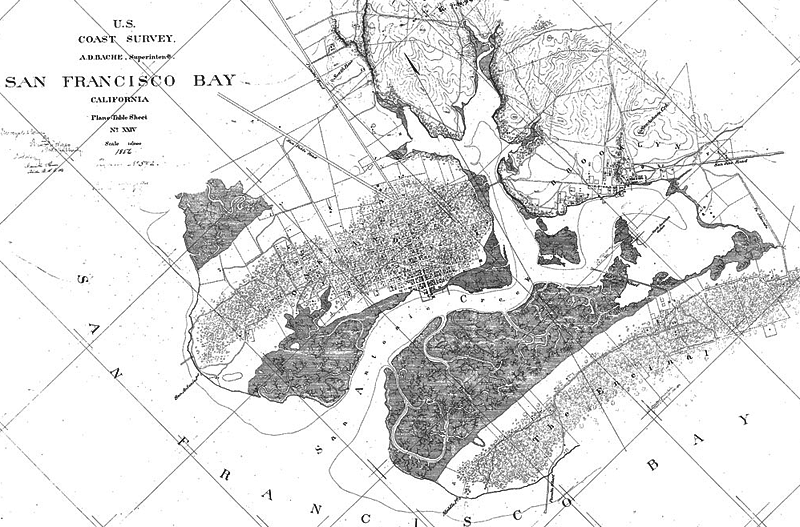
This 1856 U.S. Coast Guard survey map shows the landforms
and estuary, then known as San Antonio Creek.
Note the extensive marshlands and the land connection of Alameda ("The Encinal") to the Brooklyn
mainland. That connection was severed by the construction of the tidal
canal in the 1890s. - Bill Threlfall, 2009
Image courtesy of the United States Coast Guard.
 back
back
|