Waterfront Action Logo

Promoting public access to the Oakland-Alameda waterfront


  Select Waterfront Map:    Public Access Map | History Map                              Home | About Us | Plans & Projects | Events | Learn More | Support Us | News Room


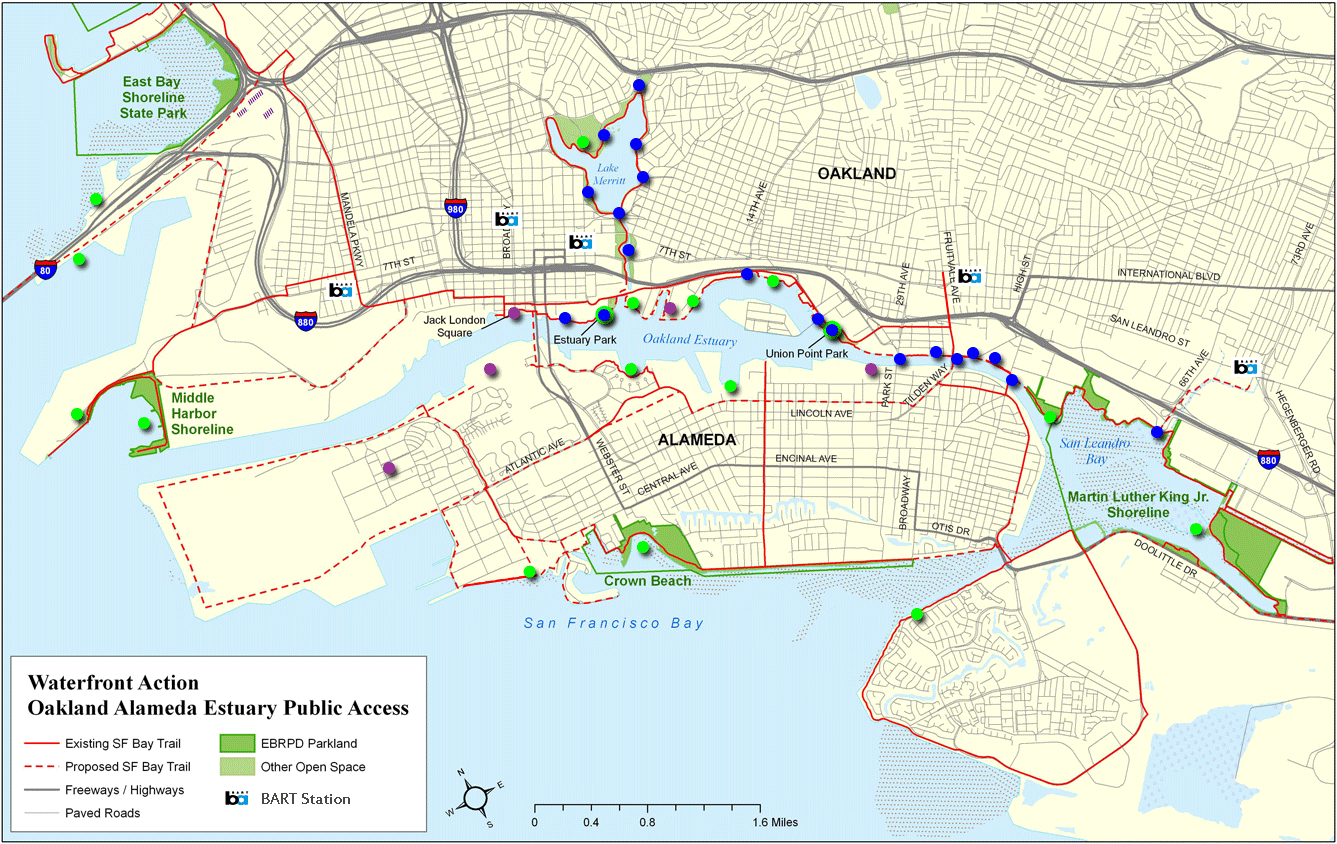
Oakland-Alameda Waterfront Public Access

See where to enjoy your waterfront at parks and the Bay Trail.
See how Measure DD projects are improving public access.


On the map, hover on a dot for a description; click the dot for detail: 

Legend:
  Parks = Waterfront Parks
  Measure DD = Oakland Measure DD Bond Projects
  Mixed-use = Commercial Mixed-use Waterfront Developments
Bay Trail = Bay Trail

Measure DD logo
Learn about the progress of
Oakland's Measure DD projects

Bay Trail Logo
Learn about the Bay Trail

Suggestions, corrections?
  Send to:

Credit and Awards
©2008 Waterfront Action, Inc.

Sorry, but a Javascript-enabled browser is required to use the map.

Site Map | Home | Contact Us | Privacy Policy