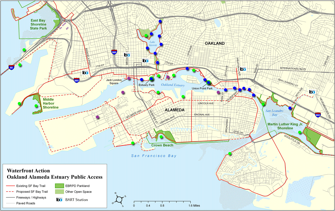
Waterfront Action Logo

      Promoting public access to our waterfront


Home | About Us | Plans & Projects | Events | Learn More | Support Us | News Room


Oakland-Alameda Waterfront Public Access

See where you can enjoy your waterfront at parks and the Bay Trail.
See how Measure DD projects are improving public access.

On the map, hover on a dot for a description; click the dot for detail: 

Legend:
  Parks = Waterfront Parks
  Measure DD = Oakland Measure DD Bond Projects
  Mixed-use = Commercial Mixed-use Waterfront Developments
Bay Trail = Bay Trail

Measure DD logo
Learn about the progress of
Oakland's Measure DD projects

Bay Trail Logo
Learn about the Bay Trail

Get a printed copy of this map...

Suggestions, corrections?
  Send to:

GIS map courtesy of East Bay Regional Parks
©2008 Waterfront Action, Inc.

Sorry, but a Javascript-enabled browser is required to use the map.

Site Map | Home | Contact Us | Privacy Policy